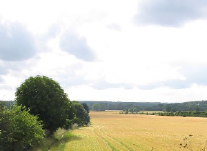
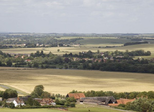
This area is in two discontinuous parts, but is composed of the West Berkshire side of the Thames valley from the Oxfordshire border to the outskirts of Reading. The Thames tow path marks the Eastern boundary.
Important Palaeolithic and Mesolithic finds are associated with the river gravels and floodplain. Bronze Age round barrows have also been identified as cropmarks. Second World War archaeology is associated with defensive features on the banks of the River Thames. There is great potential for further archaeological information from the floodplain including relating to earliest Palaeolithic activity as well as later prehistoric and Roman exploitation of the same area.
North Wessex Downs AONB HLCA Extract 22
Present Day Historic Landscape Character

There has been significant modification to the area with large-scale changes to fieldscapes in the 20th century. Most historic enclosures have been reorganised but since much of the area was historically covered in regularly-shaped fields this has had less impact than in other areas.
The development of leisure facilities has introduced a significant element to the landscape that was not previously present. Beale Park, a wildlife visitor attraction, has been created on land that was Parliamentary fields created from open field.
Layers in the Landscape
Bronze Age round barrows have also been identified as cropmarks on the floodplain, and possible prehistoric enclosures has been observed from cropmarks.

Evidence for later prehistoric and Roman exploitation of the floodplain is also apparent. Building foundations and numerous finds of Iron Age and Roman date were found near Streatley Farm in the early 19th century, some at least during gravel quarrying. The buildings seem to be regarded as Roman, and the presence of a villa has been suggested. Evidence for a villa was also found at Church Field at Basildon, during the construction of the railway in 1839.
Second World War archaeology is associated with defensive features on the bank of the River Thames.
This was an area of nucleated settlement. Villages such as Streatley and Basildon were located at the edge of the valley floor with open fields on the valley floor and common meadow grazing next to the river on the floodplain. Most of this area was covered by common downland grazing. Some areas of open field and meadow land had been enclosed into fields by the 18th century, and farms established amongst these fields. Early enclosures at Streatley Farm and Basildon Farm were of regularly-shaped fields; this suggests that they may be planned enclosures resulting from agreement between local land-holders and farmers to rationalise holdings in the common fields. Early enclosures at Westbury Farm and Scrace’s Farm were irregularly-shaped suggesting that they were created on a more piecemeal basis. The remaining areas of open field, meadow and most downland were enclosed into fields by Act of Parliament in the early 19th century.
Historic Settlement Character
Extensive settlement growth took place around Streatley in the late 19th and early 20th century and was spurred on by the construction of the railway through the area. The provision of a station serving both Streatley and Goring made working in Reading or further afield yet living in a pleasant riverside location achievable to the affluent. The housing of this period is typified by large detached villa properties. Housing growth has continued at Streatley and it is has nearly trebled in size from its historic extent; some growth has also occurred at Basildon.
Historic Farmstead Character
Some areas of open field and meadow land had been enclosed into fields by the 18th century, and farms established amongst these fields. Pre 1750 farmsteads are very rare.


