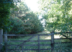
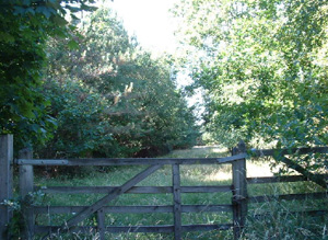
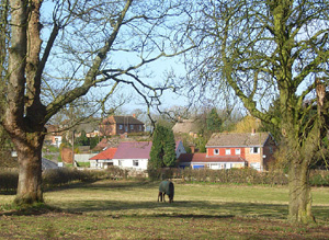
This is the South-Eastern tip of the Lambourn – Kennet watershed. It is a small, visually and geographically distinct area formed by a wooded gravel ridge between the Winterbourne Valley and the Lambourn Valley.
Most notable archaeology features relate to the Roman period; for example surviving earthwork sections of Ermin Street. There is good archaeological potential for archaeology to survive within the woodland plantations and heathland which cover this area. Surviving areas of unmodified enclosures can be used to illustrate early pre 1800 land use.
North Wessex Downs AONB HLCA Extract 17
Present Day Historic Landscape Character

The area has been transformed over the course of the 20th century by agricultural changes and afforestation. The process of rationalising historic enclosures into fields more suited to modern agriculture has taken place widely across this area and most fields in the area have been altered to some extent. An area of largely unmodified historic enclosures remains between Hoe Benham and Ownham. Sole Common has remained unenclosed.
The most substantial change in this area is the huge growth in tree-cover. The majority of Parliamentary enclosures on the heath have been turned into conifer plantations. This process had begun in the 1880s, but most plantations were put in during the mid-20th century. It is likely that the heathland was found to be unsuited to agriculture soon after its enclosure and trees were planted instead as the most productive use of the land. This has altered the feel of landscape from a visually very open one, with views into Kennet and Lambourn valleys and to the high downs, to a very enclosed area with only short horizons due to the density and extent of tree-plantations. Some blocks of secondary woodland have also grown up on previously farmed land around the fringes of the area. Ancient woodlands in the area have had mixed fortunes; one wood was cleared for agriculture and several others have been cleared of native tree cover and replanted with other species.
Some parks are present in the area but are mostly small in extent, such as Foley Lodge and Deanwood. A larger landscape park existed at Wormstall, and this seems to have been created or enlarged in the later 18th century. This park may have been laid out over an extant or deserted Medieval settlement as an early church lies within the park extent at Wickham. The parks at Foley Lodge and Deanwood have largely been adapted for recreational use and are now home to the Vineyard hotel at Stockcross and a small golf course. The park at Wormstall has remained largely unaltered.Some parks are present in the area but are mostly small in extent, such as Foley Lodge and Deanwood. A larger landscape park existed at Wormstall, and this seems to have been created or enlarged in the later 18th century. This park may have been laid out over an extant or deserted Medieval settlement as an early church lies within the park extent at Wickham. The parks at Foley Lodge and Deanwood have largely been adapted for recreational use and are now home to the Vineyard hotel at Stockcross and a small golf course. The park at Wormstall has remained largely unaltered.
Layers in the Landscape

Archaeological information in this area is limited due to the 19th and 20th plantations which now cover the areas of extensive heathland common. The most notable archaeology features relate to the Roman period, the Ermine Street crosses the North East side of the area and evidence for Roman occupation has been uncovered from the area around Wickham Green.
There was formerly a mix of early enclosures, extensive commons, small areas of woodland, dispersed settlement and some small to medium sized parks. This was a largely open landscape into the 18th century, centred on an extensive heathland common, Wickham Heath, which occupied most of the ridge. Some early enclosure fields were present around the fringes of the common; most were regularly-shaped but some irregular enclosures existed at Wickham, Stockcross and Hoe Benham. A large area of regularly-shaped early enclosures was present between Hoe Benham and Stockcross. The regularity of these fields suggests that this was a part of the common that was enclosed by agreement between commoners and local farmers. The majority of this common was enclosed into fields in the early 19th century by a series of Acts of Parliament with only a small portion around Sole Common remaining unenclosed into the 20th century.
Historic Settlement Character

The historic settlement pattern was dispersed and settlements were located on the edge of the common heath. Stockcross and Wickham seem to be common-edge settlements but the nature of Hoe Benham is less clear. The settlement at Wickham Heath does not appear to have existed in the 18th century. It was established in the 19th century, perhaps to resettle commoners turned out when the Act to enclose the common was implemented. Stockcross also seems to have grown substantially in the early 19th century and this may also have been due to resettlement of commoners, although it is also an estate village.
Historic Farmstead Character
There is a low-medium concentration of pre-1750 farmstead buildings. These farmsteads are often large with loose courtyard plans or 19th century regular courtyard plans and are associated with the valley bottom.


