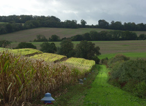
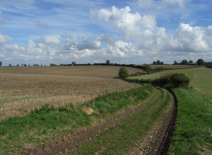
This area is formed by an area of chalk downland bounded by the river Og to the West and the Lambourn downs to the East.
There are extensive numbers of Bronze Age round barrows on higher downland areas including extant and ploughed out examples and complete barrow cemeteries. Iron Age archaeology is likewise extensive including settlements, banjo enclosures and cross dykes. There are also many known Roman sites. The extent of Medieval archaeology is particularly noteworthy including sites which can be used to illustrate activity within the former Medieval deer park of the Aldbourne Chase. This area is characterised by a greater proportion of surviving pre 1700 enclosure than the downland to the West or East which can be used to illustrate the early privatisation of the Medieval communal farming systems that had formerly supported many parishes.
North Wessex Downs AONB HLCA Extract 4
Present Day Historic Landscape Character

The development of mechanised farming over the latter half of the 20th century led to substantial change in the area with many fields being heavily altered and the remaining areas of open field and downland enclosed by new fields created around Liddington Hill and on Poulton Hill.
However, the reorganisation of the landscape has been less complete than in other parts of the AONB, and large and coherent areas of early enclosures remain across the South of the area. Here this is a much greater survival of pre 1800 enclosure interspersed with ancient woodland and replanted ancient woodland.
A small area of 18th and 19th century designed parkland surrounds Upham Court.
Layers in the Landscape

There are extensive numbers of Bronze Age round barrows on higher downland areas including extant and ploughed out examples and complete barrow cemeteries. Some of the extensive field systems identified may date to the later Bronze Age and there is evidence for later Bronze Age settlement.
Iron Age archaeology is likewise extensive including settlements, banjo enclosures and cross dykes as well as the earthwork remains of a small univallate hillfort at Liddington Castle.
There are many known Roman sites not surprising when considering Cunetio lies just to the South. The Roman Ermin Street crosses the area while to the West the road from Cirencester to Mildenhall (Cunetio) runs roughly North to South. There are also substantial Roman field systems, and the area seems to have been well farmed at this time.
The extent of Medieval archaeology is particularly noteworthy, including sites relating to the former Medieval deer park of the Aldbourne Chase.
Like neighbouring downland areas to the East, the Medieval landscape was composed of communities living in nucleated villages within open fields utilising common grazing on adjacent or nearby downland. The open fields surrounded villages within the area, such as Aldbourne, or villages beyond, such as in the Kennet Valley to the South. This gave way to open chalk downland on the higher ground above. Parliamentary enclosures of the late 18th and early 19th century were created to the West of Liddington Hill, East of Ogbourne St George, North-East of Marlborough, North of Axford and South and North East of Aldbourne. This area is characterised by a greater proportion of pre 1700 enclosure than the downland to the West or East.
Historic Settlement Character

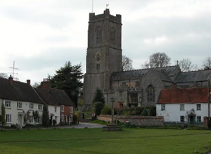
The historic settlement pattern is dominated by the nucleated village of Aldbourne, originally built around the green and the church. It was established in the 7th or 8th century AD at the junction of five dry valleys and by the Medieval period was established as a classic downland village surrounded by open fields to the North and West, with common grazing beyond. However this picture needs to be supplemented by the number of deserted Medieval villages which have been abandoned or survive as historic farmsteads such as Shaw, Snap, Woodsend and Upham. Indeed Upham Manor was the centre of a royal manor, with a hunting lodge on the edge of Aldbourne Chase. This picture was infilled by smaller hamlets and farmsteads spread throughout the remainder of the area. This settlement pattern contrasts strongly with the downland areas to the East.
Historic Farmstead Character
Historic farmsteads of a pre 1800 origin dominate, some being the remnants of once larger Medieval settlements. There is a low-medium concentration of pre-1750 farmstead buildings. These farmsteads are often large with loose courtyard plans or 19th century regular courtyard plans and are associated with the valley bottom.


