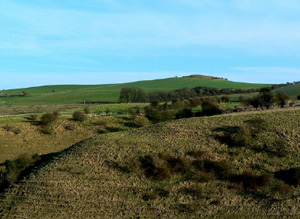
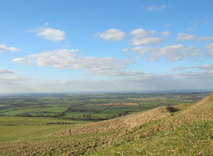
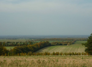
Escarpment on northern side of the AONB between Chiseldon to the West and Chilton to the East, to the South of Wantage and Didcot.
There is strong association with the Prehistoric period, with Bronze Age and Iron Age evidence being particularly rich. This includes evocative sites such as the Bronze Age Uffington White Horse and Hillfort. Significant pockets of open downland survive on the steep sides of the escarpment slopes for example around Liddington hill. These are an important historical survival representing a fraction of the former extent of chalk downland. In addition pockets of pre 1700 regular enclosure survive in the West of the area and 1700 to 1900 enclosure in the East.
North Wessex Downs AONB HLCA Extract 5
Present Day Historic Landscape Character

Today open land only survives in pockets on the steep sides of the escarpment slopes, for example around Liddington hill. The historic landscape is dominated by 20th century fields including new fields which enclosed the last areas of open land, for example around Bishopstone Down and around Letcombe.
In addition pockets of pre 1700 regular enclosure survive in the West of the area and 1700 to 1900 enclosure in the East. The historic parks also survived in today’s landscape.
Layers in the Landscape

The prominent position of the scarp edge and the survival of unimproved grassland means that this area is associated with a number of prominent, extant and nationally important earthworks. The earliest archaeological evidence is for stray Mesolithic finds and flint scatters. Neolithic archaeology includes flint scatters, finds and the excavated long barrow at Waylands Smithy and another example at Uffington.
An iconic element is the Uffington White Horse situated below Uffington Castle hillfort. In 1995 Optical Stimulated Luminescence dating was used to date the figure to the Late Bronze Age or Early Iron Age, and it was probably constructed between 1380 and 550 BC.
Iron Age archaeology is likewise extensive including a string of prominent Iron Age hillforts including Hardwell Camp, Uffington Castle, Alfred’s Castle and other earthworks including cross dykes There are substantial Iron Age/Romano British field systems and the area seems to have been well farmed at this time. There is some evidence for the location of Roman farmsteads which complements the evidence for nearby high status buildings such as the Roman Villa at Strevall Farm
The extent of Medieval archaeology is particularly noteworthy. There are a number of deserted or shrunken villages, such as at Overtown, these are surrounded by relict Medieval fields, ridge and furrow. Lynchets are a prominent feature on the scarp slope and other features including pillow mounds.
Like neighbouring downland areas, the Medieval landscape was composed of communities within open fields utilising common grazing on adjacent or nearby downland, for example at Lammy Down. In the East of the area this pattern survived into the 1700s. However in the West of the area around Chiseldon and Liddington the open fieldscapes were replaced by regular pre 1700 enclosure along the edge of the chalk escarpment which marks the northern edge of the area.
Earlier irregular enclosure existed to the West of Chiseldon. These early enclosures were irregularly-shaped and slotted into the framework of the landscape that had been established by a dense network of deeply incised roads and tracks and open field boundaries. This suggests that they were enclosed on a gradual, piecemeal basis. Parliamentary enclosures of the late 18th and early 19th century across the West of the area were created to the South of Sparsholt and in the vicinity of Lockinge.
However a string of small historic parks and gardens were created between 1700 and 1900, for example Ashdown Park, which started as a Medieval deer park; Arnhill Park – some of which was associated with small pockets of ancient woodland
Historic Settlement Character

The historic settlement pattern is dominated by nucleated villages along the spring line at the base of the scarp slope or distributed along the combes and valleys which score into the chalk escarpment face such as at Letcombe Regis. The exception is Chiseldon which is located at the top of the chalk escarpment on a plateau before the downland rises further at another escarpment.
Historic Farmstead Character
There are only a few hamlet farm clusters on the eastern side of the area.


