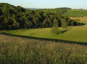
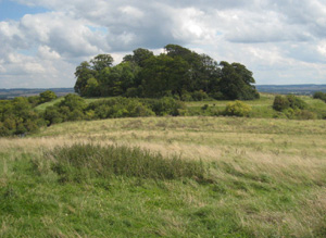
Downland on the North-Eastern edge of the AONB to the West and South of the Thames Flood Plain centred on Blewbury
In the lower and middle valley Neolithic material is common. Earlier Bronze Age round barrows are widespread. The Late Bronze Age linear earthwork Grim’s Ditch is visible as earthworks and cropmarks. There is significant cropmark evidence of Iron Age and Romano-British activity including potential Roman settlements and industrial sites. Field systems of late Iron Age/Romano-British date survive as earthworks at Streatley Warren and Hollies Wood. Later Medieval activity on the downland areas includes extensive areas of lynchets. Large areas of unmodified 1700 to 1900 enclosure survive across the centre of the area below the downland.
North Wessex Downs AONB HLCA Extract 11
Present Day Historic Landscape Character

Today, 20th century fields created by reorganising the parliamentary enclosures dominate. These are modern fields formed through the consolidation or amalgamation of existing, historic, enclosures into more regular holdings, usually to enable more efficient, mechanised arable agriculture. Traces of the earlier field patterns will remain fossilised in these alterations.
These are interspersed with large areas of unmodified 1700 to 1900 enclosure across the centre of the area below the downland.
South of Blewbury large areas of gallops interspersed with regular blocks of woodland plantation have been created. New plantations of sinuous blocks of woodland have also been created in the parishes of Moulsford, Ashton Tirrold and Ashton Upthorpe, and areas of ancient woodland replanted. Small areas of open chalk downland survive associated with small areas of ancient woodland in the region of Mouslford Downs and areas to the East. The historic park at Rush Court survives, though in some areas its character has been eroded.
Layers in the Landscape

Earlier prehistoric archaeology relates to numerous flint scatters and findspots from both the Mesolithic and Neolithic period. Earlier Bronze Age round barrows are widespread many existing only as ring ditches. Part of the Late Bronze Age linear earthwork Grim’s Ditch is visible as earthworks and cropmarks on aerial photographs.
Possible Medieval and/or Post Medieval ridge and furrow and headlands are visible as cropmarks on aerial photographs. Later Medieval activity on the downland areas includes extensive areas of lynchets which have been given a Medieval and Post Medieval date, and pillow mounds.
Historically this area marked the transition from open chalk downland in the South which provided grazing for Medieval settlements and open fields closer to the settlement utilising common grazing on adjacent or nearby downland. Historically parishes were linear encompassing a strip of downland, open fields and meadows.
Historic Settlement Character

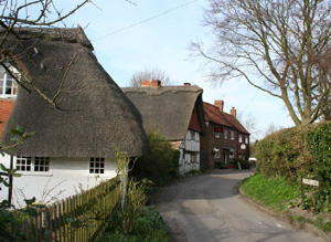
There is one nucleated villages in the centre of the area. Blewbury is a classic springline settlement at the foot of the chalk escarpment. This has undergone post 1900 expansion but the historic plan remains. Building materials include thatch, red brick and weatherboard. Other small patches of 19th and 20th century settlement expansion in the far North of the area relates to settlement which is outside of the AONB.
Historic Farmstead Character
There are isolated farmsteads distributed across the southern half of the area. There is a low-medium concentration of pre-1750 farmstead buildings. These farmsteads are often large with loose courtyard plans or 19th century regular courtyard plans and are associated with the valley bottom. Large timber-frame barns, some of 15th century date but more often of 17th – 18th century date may be typical of many farms.


