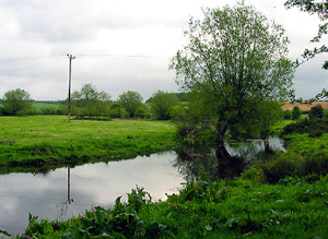
This area comprises the middle and lower Pang Valley from above Hampstead Norreys to the Thames at Pangbourne. It also incorporates the area of the Sulham Gap to the East.
There is a concentration of significant early prehistoric sites, including a potential Palaeolithic- Mesolithic transition site at Nunhide farm. Significant Romano-British features, including a villa at Eling and Maidenhatch. Bucklebury is known to have been a Medieval royal manor and possibly the site of an Early Medieval ‘proto-urban’ centre. Surviving areas of earlier pre 1800 enclosures and settlement patterns on the Sulham Gap can be used to illustrate early pre modern land use. The historic gardens and park at Purley Hall have a strong illustrative interest and an associative interest due to their known link with Charles Bridgeman.
North Wessex Downs AONB HLCA Extract 19
Present Day Historic Landscape Character

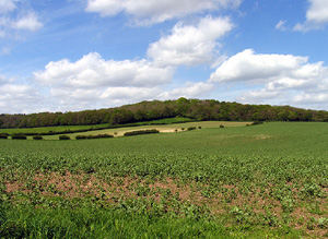
There have been major changes to the agricultural landscape of the Pang Valley. Most historic fields have been rationalised into fields better suited to modern agriculture and much of this has been through removal of historic field boundaries. All former water meadows have now been converted to arable. Although most enclosed meadows were also reorganised, blocks of them survive between Everington and Hampstead Norreys and around Stanford Dingley. The construction of the M4 further contributed to the reorganisation of the landscape by disrupting and truncating fieldscapes.
Substantial changes have occurred in the tree-cover of the area. Although no woodland has been cleared for other land-uses, large areas of ancient woodland have been cleared of native tree cover and replanted with other species. Large tree plantations have been created at several locations: the largest are between Frilsham and Yattendon, and between Stanford Dingley and Bradfield
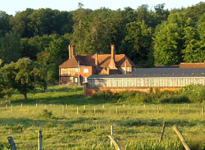
Much of the parkland in the area has been enclosed and converted to arable fields and many parks now have only small stubs of grounds immediately around the house, such as Frilsham Park and Bucklebury House. Parks have also been subject to change of use, with housing developed on sections of Yattendon Park and a school established at Marlston House.
In the Sulham Gap There have been varying degrees of change in this area: whilst fieldscapes have been substantially altered and recent leisure developments have had an effect on the area, there has been only some change to the extent of tree-cover and very little settlement growth.
Layers in the Landscape

Evidence of prehistoric activity is not very common.
Significant Romano-British features, including a villa at Eling exist, but activity is not widespread over the area. The site has not been fully excavated and its date and whether any preceding Iron Age settlement existed are unknown. A villa and kiln were excavated at Maidenhatch prior to construction of the M4. Scatters of building debris in plough soil South-West of Bucklebury have been interpreted as a possible villa.
The Medieval landscape of the Pang Valley was characterised by nucleated settlements, mostly sited on the valley floor, surrounded by open fields on the valley slopes and with common meadow grazing by the riverside. Most of the open fields had been enclosed into fields by the 18th century. The majority of these fields were irregularly-shaped which suggests that much of the land was probably enclosed on a piecemeal basis. Areas of regularly shaped early enclosures existed between Yattendon and Beche Farm, between Bucklebury and Stanford Dingley and around Bradfield. The regularity of these fields suggests that they were created in a more planned fashion and may result from agreement between local land-holders and farmers to rationalise holdings in the common fields and grazing or woods and turn them into fields. The valley floor meadows had also been largely enclosed by the 18th century; most were simply enclosed into pasture fields. Areas around Frilsham, between Bucklebury and Stanford Dingley and between Bradfield and Tidmarsh, were turned into water-meadows over the course of the 18th century. Parliamentary enclosures were only found around Hampstead Norreys and a small area at Frilsham.
In contrast the area of the Sulham Gap was well-wooded and characterised by early enclosure fields and a dispersed settlement pattern.
Historic Settlement Character

In the Pang Valley the historic settlement pattern of the area was nucleated and composed mainly of villages and hamlets located on the valley floor, such as Pangbourne, Bucklebury, Frilsham and Hampstead Norreys. Yattendon was an exception to this pattern and lay at the junction of several routes through the area on the crest of the Eastern watershed. The dominant building material is red brick. The historic settlement pattern in the Sulham Gap of the area was a mix of small hamlets, such as Sulham and North Street, and numerous small farms.
Historic Farmstead Character
Farms were found in the area but were not particularly common features within the Pang Valley landscape. They were located either on the valley floor between villages or on the upper slopes of the valley; most were named after nearby places or topographic features. The dispersed settlement pattern in the Sulham Gap means small farms are more common.


