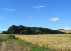
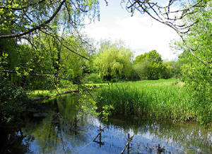
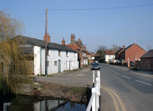
This area is the Lambourn valley and the surrounding downs from Bagnor to the valley heading North-West of Lambourn.
This area has important and rare surviving evidence for Palaeolithic activity. There is strong time depth relating to the prehistoric period with Neolithic and Early Bronze Age evidence being particular rich. The Lambourn Seven Barrows cemetery has particular illustrative interest. There is significant cropmark and excavated evidence of Romano- British activity, particularly relating to settlements at Boxford and Maddle farm. There is evidence for early Medieval settlement in the valley bottom and a possible Royal enclosure at Lambourn and a wealth of Medieval archaeology. There is a conglomeration of later Post-medieval built architectural heritage in the valley bottom.
North Wessex Downs AONB HLCA Extract 7
Present Day Historic Landscape Character

Agricultural mechanisation from the mid 20th century led to a dramatic alteration of this landscape as existing fields were amalgamated into larger holdings, either through boundary removal or through reorganisation. Many historic features, such as hedgerows, were removed, creating expanses of relatively featureless arable fields.
Due to the growth of Lambourn as a nationally important centre of the racehorse industry, large parts of the landscape are now covered by land-uses related to horse breeding and training.
A large American military base exists at Welford. The base started as an RAF airfield in WWII and has now become one of the USAF’s most significant European bomb stores. Most previous land-use features, including field boundaries and a large area of ancient woodland, were removed by construction of the base.
Layers in the Landscape

There is significantly more evidence of earlier prehistoric activity in the Lower Lambourn than in adjacent parts of the valley and watershed. Palaeolithic material has been recovered near Woodspeen and Mesolithic material was also found at this location. Neolithic material is also more widespread and flint tools have been found at several sites. There is also some Neolithic evidence at the head of the Lambourn Valley. There is one Neolithic long barrow.
Evidence of Bronze Age activity in the lower valley comes from probable barrow sites and circular earthworks There is significant cropmark evidence of later prehistoric settlement and farming all along the valley, in particular on the valley sides and fields have generally been ascribed a later prehistoric/Romano-British date.
The Medieval landscape of this area was based on nucleated settlements on the valley floor, with open fields on the valley sides and common grazing on riverside meadows and downs at the head of the valley and on its sides. The majority of the open fields south of East Garston were enclosed into fields by the 18th century. The majority of the remaining open fields and downs, including almost all of Lambourn parish, were enclosed into fields through Act of Parliament in the early 19th century. The only unenclosed downland that remained were small areas West of Lambourn and north of East Garston.
The only large ancient wood was on the Southern edge of Welford Park, the single substantial park in the area.
Historic Settlement Character

Settlement was linear but nucleated and concentrated in a few large villages and hamlets of Medieval or earlier origin. These were sited on the valley floor and were spaced at fairly regular intervals. Timber-framing was the traditional construction form across much of the area until the later 17th century, after which time brick became the dominant walling material Chalk cob was also widely used for cottages and boundary walls Brick combined with flint is also characteristic – its use dating mainly from the late 18th and 19th centuries. Settlement growth has been modest and confined largely to infill or growth around existing settlements and has centred on East Garston, West Shefford and Boxford.
Historic Farmstead Character
Farms were not common and were located either along the river in gaps between the hamlets and villages or, more commonly, on the upper slopes of the valley. Most were named after adjacent settlements or topographic features. There is a low to medium concentration of pre-1750 farmstead buildings.


